Readings Newsletter
Become a Readings Member to make your shopping experience even easier.
Sign in or sign up for free!
You’re not far away from qualifying for FREE standard shipping within Australia
You’ve qualified for FREE standard shipping within Australia
The cart is loading…


This title is printed to order. This book may have been self-published. If so, we cannot guarantee the quality of the content. In the main most books will have gone through the editing process however some may not. We therefore suggest that you be aware of this before ordering this book. If in doubt check either the author or publisher’s details as we are unable to accept any returns unless they are faulty. Please contact us if you have any questions.
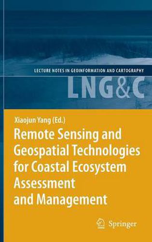
In this landmark publication, leading experts detail how remote sensing and related geospatial technologies can be used for coastal ecosystem assessment and management.
This book is divided into three major parts. In the first part several conceptual and technical issues of applying remote sensing and geospatial technologies in the coastal environment are examined. The second part showcases some of the latest developments in the use of remote sensing and geospatial technologies when characterizing coastal waters, submerged aquatic vegetation, benthic habitats, shorelines, coastal wetlands and watersheds. Finally, the last part demonstrates a watershed-wide synthetic approach that links upstream stressors with downstream responses for integrated coastal ecosystem assessment and management.
$9.00 standard shipping within Australia
FREE standard shipping within Australia for orders over $100.00
Express & International shipping calculated at checkout
This title is printed to order. This book may have been self-published. If so, we cannot guarantee the quality of the content. In the main most books will have gone through the editing process however some may not. We therefore suggest that you be aware of this before ordering this book. If in doubt check either the author or publisher’s details as we are unable to accept any returns unless they are faulty. Please contact us if you have any questions.
In this landmark publication, leading experts detail how remote sensing and related geospatial technologies can be used for coastal ecosystem assessment and management.
This book is divided into three major parts. In the first part several conceptual and technical issues of applying remote sensing and geospatial technologies in the coastal environment are examined. The second part showcases some of the latest developments in the use of remote sensing and geospatial technologies when characterizing coastal waters, submerged aquatic vegetation, benthic habitats, shorelines, coastal wetlands and watersheds. Finally, the last part demonstrates a watershed-wide synthetic approach that links upstream stressors with downstream responses for integrated coastal ecosystem assessment and management.