Readings Newsletter
Become a Readings Member to make your shopping experience even easier.
Sign in or sign up for free!
You’re not far away from qualifying for FREE standard shipping within Australia
You’ve qualified for FREE standard shipping within Australia
The cart is loading…


This title is printed to order. This book may have been self-published. If so, we cannot guarantee the quality of the content. In the main most books will have gone through the editing process however some may not. We therefore suggest that you be aware of this before ordering this book. If in doubt check either the author or publisher’s details as we are unable to accept any returns unless they are faulty. Please contact us if you have any questions.
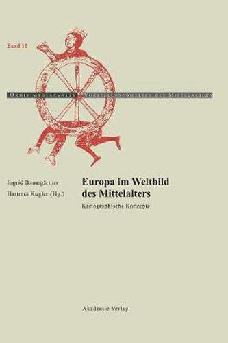
Angesichts aktueller Diskussionen uber den Kulturraum Europa unternehmen es die Autoren des Bandes, die kartographisch-geographischen Grundlagen des Mittelalters zu erfassen und die kulturwissenschaftlich determinierten Funktionen des Kartierens am Beispiel Europa zu erlautern. Ziel ist es, kartographische Darstellungspraktiken in historiographische und literarische Wissens- und UEberlieferungskontexte einzubinden und den Kontinent als historische Groesse mit unterschiedlichen Deutungspotentialen zu begreifen. Aus dem Inhalt: Ingrid Baumgartner: Europa in der Kartographie des Mittelalters. Reprasentationen - Grenzen - Paradigmen REPRAESENTATIONEN Alfred Stuckelberger: Das Europabild bei Ptolemaios Hartmut Kugler: Europa pars quarta. Der Teil und das Ganze im ‘Liber Floridus’ Patrick Gautier Dalche Representations geographiques de lEurope - septentrionale, centrale et orientale - au moyen age Ingrid Baumgartner: Graphische Gestalt und Signifikanz. Europa in den Weltkarten des Beatus von Liebana und des Ranulf Higden EUROPA UND DER ORIENT Paul D. A. Harvey: Europa und das Heilige Land Andreas Kaplony: Ist Europa eine Insel? Europa auf der rechteckigen Weltkarte des arabischen Book of Curiosities Anna-Dorothee von den Brincken: Europa um 1320 auf zwei Weltkarten suditalienischer Provenienz. Die Karte zur ‘Chronologia magna’ des Paulinus Minorita und die Douce-Karte GRENZZIEHUNGEN UND GRENZERFAHRUNGEN Evelyn Edson: Dacia ubi et Gothia. Die nordoestliche Grenze Europas in der mittelalterlichen Kartographie Patricia Licini: European and Ottoman Landmarks from a Portolan Chart at the Time of Enea Silvio Piccolomini Stefan Schroeder: Grenzerfahrungen. Mittelalterliche Reisende an den Randern Europas Margriet Hoogvliet: The Wonders of Europe. From the Middle Ages to the sixteenth Century PARADIGMEN Andrew Gow: Empirical Empire. Eurocentrism and Cosmopolitism in the last Mappamundi (Fra Mauro) Piero Falchetta: The Use of Portolan Charts in European Navigation during the Middle Ages Martina Stercken: Regionale Identitat im spatmittelalterlichen Europa. Kartographien der Eidgenossenschaft
$9.00 standard shipping within Australia
FREE standard shipping within Australia for orders over $100.00
Express & International shipping calculated at checkout
This title is printed to order. This book may have been self-published. If so, we cannot guarantee the quality of the content. In the main most books will have gone through the editing process however some may not. We therefore suggest that you be aware of this before ordering this book. If in doubt check either the author or publisher’s details as we are unable to accept any returns unless they are faulty. Please contact us if you have any questions.
Angesichts aktueller Diskussionen uber den Kulturraum Europa unternehmen es die Autoren des Bandes, die kartographisch-geographischen Grundlagen des Mittelalters zu erfassen und die kulturwissenschaftlich determinierten Funktionen des Kartierens am Beispiel Europa zu erlautern. Ziel ist es, kartographische Darstellungspraktiken in historiographische und literarische Wissens- und UEberlieferungskontexte einzubinden und den Kontinent als historische Groesse mit unterschiedlichen Deutungspotentialen zu begreifen. Aus dem Inhalt: Ingrid Baumgartner: Europa in der Kartographie des Mittelalters. Reprasentationen - Grenzen - Paradigmen REPRAESENTATIONEN Alfred Stuckelberger: Das Europabild bei Ptolemaios Hartmut Kugler: Europa pars quarta. Der Teil und das Ganze im ‘Liber Floridus’ Patrick Gautier Dalche Representations geographiques de lEurope - septentrionale, centrale et orientale - au moyen age Ingrid Baumgartner: Graphische Gestalt und Signifikanz. Europa in den Weltkarten des Beatus von Liebana und des Ranulf Higden EUROPA UND DER ORIENT Paul D. A. Harvey: Europa und das Heilige Land Andreas Kaplony: Ist Europa eine Insel? Europa auf der rechteckigen Weltkarte des arabischen Book of Curiosities Anna-Dorothee von den Brincken: Europa um 1320 auf zwei Weltkarten suditalienischer Provenienz. Die Karte zur ‘Chronologia magna’ des Paulinus Minorita und die Douce-Karte GRENZZIEHUNGEN UND GRENZERFAHRUNGEN Evelyn Edson: Dacia ubi et Gothia. Die nordoestliche Grenze Europas in der mittelalterlichen Kartographie Patricia Licini: European and Ottoman Landmarks from a Portolan Chart at the Time of Enea Silvio Piccolomini Stefan Schroeder: Grenzerfahrungen. Mittelalterliche Reisende an den Randern Europas Margriet Hoogvliet: The Wonders of Europe. From the Middle Ages to the sixteenth Century PARADIGMEN Andrew Gow: Empirical Empire. Eurocentrism and Cosmopolitism in the last Mappamundi (Fra Mauro) Piero Falchetta: The Use of Portolan Charts in European Navigation during the Middle Ages Martina Stercken: Regionale Identitat im spatmittelalterlichen Europa. Kartographien der Eidgenossenschaft
Search our extensive online catalogue.
