Readings Newsletter
Become a Readings Member to make your shopping experience even easier.
Sign in or sign up for free!
You’re not far away from qualifying for FREE standard shipping within Australia
You’ve qualified for FREE standard shipping within Australia
The cart is loading…


This title is printed to order. This book may have been self-published. If so, we cannot guarantee the quality of the content. In the main most books will have gone through the editing process however some may not. We therefore suggest that you be aware of this before ordering this book. If in doubt check either the author or publisher’s details as we are unable to accept any returns unless they are faulty. Please contact us if you have any questions.
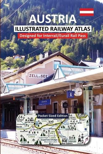
AUSTRIA - ILLUSTRATED RAILWAY ATLAS
This comprehensive railway atlas is specially designed for Rail Pass users, featuring a highly detailed map of Austria's entire railway network and major bus routes, along with key Alpine border routes in Southern Germany, Eastern Switzerland, Southern Czechia, Slovenia, and Northern Italy. Instantly identify Austria's most spectacular scenic routes and make the most of your journey while immersing yourself in the breathtaking landscapes and rich cultural heritage.
Explore Austria's Railway Network with Ease
The Illustrated Railway Atlas provides clear identification of the entire OEBB Austrian railway network, including world-famous scenic routes such as the UNESCO-listed Semmering Railway. Easily recognizable ICONS identify UNESCO sites, historic castles, medieval towns, Cathedrals and protected natural landscapes, helping you focus on the routes and destinations that best match your interests.
What's Inside?
? Stunning full-color photographs and expert travel tips covering 17 incredible destinations including Vienna, Feldkirch, Graz, Melk, Salzburg, and Zell am See.
? Detailed scenic route guides, featuring breath-taking journeys eg Bischofshofen ? Innsbruck and Gmunden ? Hallstatt, with photos and introductions so you know what to expect.
Additional Features:
Quick-reference country-wide mini InfoRailMap, highlighting major tourist locations, scenic routes, and an Atlas page index. Easy-to-read legend explaining symbols for UNESCO sites, castles, medieval towns, and Cathedrals. Mini map of Austria with page numbers conveniently placed on the back cover. A-Z grid index for fast identification of key tourist destinations. High-speed routes clearly marked-orange for compulsory reservations and purple for no extra costs. Main railway lines, local routes, and bus connections easily distinguishable (pink lines). Highlighted scenic routes to help you plan the most picturesque and enjoyable journeys. Ski resorts, ski lifts, and popular hiking destinations marked for year-round adventure planning. National parks and stunning natural landscapes clearly labeled. Mountain ranges with elevation details and major inland lakes identified. Discover Austria's tallest mountains and longest suspension bridges.
$9.00 standard shipping within Australia
FREE standard shipping within Australia for orders over $100.00
Express & International shipping calculated at checkout
This title is printed to order. This book may have been self-published. If so, we cannot guarantee the quality of the content. In the main most books will have gone through the editing process however some may not. We therefore suggest that you be aware of this before ordering this book. If in doubt check either the author or publisher’s details as we are unable to accept any returns unless they are faulty. Please contact us if you have any questions.
AUSTRIA - ILLUSTRATED RAILWAY ATLAS
This comprehensive railway atlas is specially designed for Rail Pass users, featuring a highly detailed map of Austria's entire railway network and major bus routes, along with key Alpine border routes in Southern Germany, Eastern Switzerland, Southern Czechia, Slovenia, and Northern Italy. Instantly identify Austria's most spectacular scenic routes and make the most of your journey while immersing yourself in the breathtaking landscapes and rich cultural heritage.
Explore Austria's Railway Network with Ease
The Illustrated Railway Atlas provides clear identification of the entire OEBB Austrian railway network, including world-famous scenic routes such as the UNESCO-listed Semmering Railway. Easily recognizable ICONS identify UNESCO sites, historic castles, medieval towns, Cathedrals and protected natural landscapes, helping you focus on the routes and destinations that best match your interests.
What's Inside?
? Stunning full-color photographs and expert travel tips covering 17 incredible destinations including Vienna, Feldkirch, Graz, Melk, Salzburg, and Zell am See.
? Detailed scenic route guides, featuring breath-taking journeys eg Bischofshofen ? Innsbruck and Gmunden ? Hallstatt, with photos and introductions so you know what to expect.
Additional Features:
Quick-reference country-wide mini InfoRailMap, highlighting major tourist locations, scenic routes, and an Atlas page index. Easy-to-read legend explaining symbols for UNESCO sites, castles, medieval towns, and Cathedrals. Mini map of Austria with page numbers conveniently placed on the back cover. A-Z grid index for fast identification of key tourist destinations. High-speed routes clearly marked-orange for compulsory reservations and purple for no extra costs. Main railway lines, local routes, and bus connections easily distinguishable (pink lines). Highlighted scenic routes to help you plan the most picturesque and enjoyable journeys. Ski resorts, ski lifts, and popular hiking destinations marked for year-round adventure planning. National parks and stunning natural landscapes clearly labeled. Mountain ranges with elevation details and major inland lakes identified. Discover Austria's tallest mountains and longest suspension bridges.
Search our extensive online catalogue.
