Readings Newsletter
Become a Readings Member to make your shopping experience even easier.
Sign in or sign up for free!
You’re not far away from qualifying for FREE standard shipping within Australia
You’ve qualified for FREE standard shipping within Australia
The cart is loading…


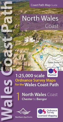
One of seven handy, lightweight, pocket sized map bookscovering the whole of the 870 mile/1400 kilometre Wales Coast Path.
This volume covers North Wales from Chester to Bangor and includes enhanced large scale (1:25,000) Ordnance Survey mapping in a handy atlas format, with extracts from large scale Explorer maps 266, 265, 264 and OL17.
The official route of the Wales Coast Path is highlighted and on-map symbols show amenities at main towns and villages. There is an introduction and additional useful information.
$9.00 standard shipping within Australia
FREE standard shipping within Australia for orders over $100.00
Express & International shipping calculated at checkout
Stock availability can be subject to change without notice. We recommend calling the shop or contacting our online team to check availability of low stock items. Please see our Shopping Online page for more details.
One of seven handy, lightweight, pocket sized map bookscovering the whole of the 870 mile/1400 kilometre Wales Coast Path.
This volume covers North Wales from Chester to Bangor and includes enhanced large scale (1:25,000) Ordnance Survey mapping in a handy atlas format, with extracts from large scale Explorer maps 266, 265, 264 and OL17.
The official route of the Wales Coast Path is highlighted and on-map symbols show amenities at main towns and villages. There is an introduction and additional useful information.
Search our extensive online catalogue.
