Readings Newsletter
Become a Readings Member to make your shopping experience even easier.
Sign in or sign up for free!
You’re not far away from qualifying for FREE standard shipping within Australia
You’ve qualified for FREE standard shipping within Australia
The cart is loading…


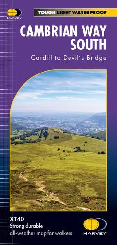
The Cambrian Way is a challenging mountain trail that runs from Cardiff Castle in South Wales to Conwy Castle in North Wales.
The entire route is 479km (298 miles) long and has nearly 24,000 metres of elevation - the route goes over many of Wales' major mountains and takes in some of the country's finest scenery, traversing both Bannau Brycheiniog (Brecon Beacons) and Eryri (Snowdonia) National Parks.
The route takes approximately 3 weeks to walk and is covered on 2 separate waterproof maps - Cambrian Way South (Cardiff to Devil's Bridge) and Cambrian Way North (Devil's bridge to Conwy).
As this is often a remote route, a map and compass are essential for the long, un-waymarked stretches of exposed and unspoiled wilderness. If you like peace and quiet then this is the walk for you!
The entire route across two maps; including sections through Bannau Brycheiniog National Park, the Cambrian Mountains and Eryri National Park A good week's walking on each map Information on accommodation and services Lightweight, detailed, clear and easy to read. The route is clearly highlighted in red Printed on tough 100% waterproof, tearproof paper Full map legend in English and Welsh
$9.00 standard shipping within Australia
FREE standard shipping within Australia for orders over $100.00
Express & International shipping calculated at checkout
Stock availability can be subject to change without notice. We recommend calling the shop or contacting our online team to check availability of low stock items. Please see our Shopping Online page for more details.
The Cambrian Way is a challenging mountain trail that runs from Cardiff Castle in South Wales to Conwy Castle in North Wales.
The entire route is 479km (298 miles) long and has nearly 24,000 metres of elevation - the route goes over many of Wales' major mountains and takes in some of the country's finest scenery, traversing both Bannau Brycheiniog (Brecon Beacons) and Eryri (Snowdonia) National Parks.
The route takes approximately 3 weeks to walk and is covered on 2 separate waterproof maps - Cambrian Way South (Cardiff to Devil's Bridge) and Cambrian Way North (Devil's bridge to Conwy).
As this is often a remote route, a map and compass are essential for the long, un-waymarked stretches of exposed and unspoiled wilderness. If you like peace and quiet then this is the walk for you!
The entire route across two maps; including sections through Bannau Brycheiniog National Park, the Cambrian Mountains and Eryri National Park A good week's walking on each map Information on accommodation and services Lightweight, detailed, clear and easy to read. The route is clearly highlighted in red Printed on tough 100% waterproof, tearproof paper Full map legend in English and Welsh
Search our extensive online catalogue.
