Readings Newsletter
Become a Readings Member to make your shopping experience even easier.
Sign in or sign up for free!
You’re not far away from qualifying for FREE standard shipping within Australia
You’ve qualified for FREE standard shipping within Australia
The cart is loading…


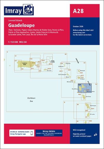
Leeward IslandsPlans included:Deshaies (1:25 000)Pigeon Island (1:25 000)Marina de Riviere Sens (1:10 000)Pointe-a-Pitre Approaches (1:50 000)Pointe-a-Pitre (1:25 000)Gosier (1:30 000)Sainte Francois & Marina de la Grande Saline (1:10 000)Port Louis (1:20 000)Iles de la Petite Terre (1:50 000)On this 2017 edition the latest information on Marine Reserves is shown. The revised buoyed approach to Pointe a Pitre is shown and a revised plan showing the new channel along with recommended tracks is included. The plan of Deshaies has been extended to show a greater approach from the south.A new plan of Pigeon Island is included, showing anchorages and the marine reserve.The chart specification has been improved to show coloured light flashes. There has been general updating throughout.
$9.00 standard shipping within Australia
FREE standard shipping within Australia for orders over $100.00
Express & International shipping calculated at checkout
Stock availability can be subject to change without notice. We recommend calling the shop or contacting our online team to check availability of low stock items. Please see our Shopping Online page for more details.
Leeward IslandsPlans included:Deshaies (1:25 000)Pigeon Island (1:25 000)Marina de Riviere Sens (1:10 000)Pointe-a-Pitre Approaches (1:50 000)Pointe-a-Pitre (1:25 000)Gosier (1:30 000)Sainte Francois & Marina de la Grande Saline (1:10 000)Port Louis (1:20 000)Iles de la Petite Terre (1:50 000)On this 2017 edition the latest information on Marine Reserves is shown. The revised buoyed approach to Pointe a Pitre is shown and a revised plan showing the new channel along with recommended tracks is included. The plan of Deshaies has been extended to show a greater approach from the south.A new plan of Pigeon Island is included, showing anchorages and the marine reserve.The chart specification has been improved to show coloured light flashes. There has been general updating throughout.
Search our extensive online catalogue.
