Readings Newsletter
Become a Readings Member to make your shopping experience even easier.
Sign in or sign up for free!
You’re not far away from qualifying for FREE standard shipping within Australia
You’ve qualified for FREE standard shipping within Australia
The cart is loading…


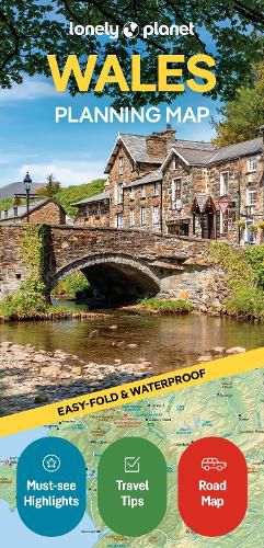
Chart your dream trip to Wales with Lonely Planet's Wales Planning Map, the ultimate travel tool to help you navigate your way around this amazing country.
Explore Skomer Island for unrivalled close-ups of home-making puffins, discover the beautiful golden beaches of the Gower Peninsula, climb or take the train to the summit of Mount Snowdon, and decide where to go and what to see next on a route that works for you.
Inside Lonely Planet's Wales Planning Map:
Full colour map in a durable easy-fold format Waterproof and packaged in a handy slipcase Alphanumeric grid to find points of interest easily Transport planner with average travel times to help you get around Top picks of must-see highlights including the best captivating castles, outdoor activities, parks and gardens, heritage and history, mountains and moors, popular pubs Essential travel tips and nuts and bolts information on big events, Welsh words, local transport Beautiful photography and detailed mapping Covers: Cardiff, Brecon Beacons, Swansea, the Gower, Carmarthenshire, Pembrokeshire, Aberystwyth, Snowdonia, Anglesey and more
Get ready for your next adventure with Lonely Planet's Wales Planning Map, the ultimate navigation tool to inspire your upcoming trip and take you to the heart of Wales - your way.
$9.00 standard shipping within Australia
FREE standard shipping within Australia for orders over $100.00
Express & International shipping calculated at checkout
Chart your dream trip to Wales with Lonely Planet's Wales Planning Map, the ultimate travel tool to help you navigate your way around this amazing country.
Explore Skomer Island for unrivalled close-ups of home-making puffins, discover the beautiful golden beaches of the Gower Peninsula, climb or take the train to the summit of Mount Snowdon, and decide where to go and what to see next on a route that works for you.
Inside Lonely Planet's Wales Planning Map:
Full colour map in a durable easy-fold format Waterproof and packaged in a handy slipcase Alphanumeric grid to find points of interest easily Transport planner with average travel times to help you get around Top picks of must-see highlights including the best captivating castles, outdoor activities, parks and gardens, heritage and history, mountains and moors, popular pubs Essential travel tips and nuts and bolts information on big events, Welsh words, local transport Beautiful photography and detailed mapping Covers: Cardiff, Brecon Beacons, Swansea, the Gower, Carmarthenshire, Pembrokeshire, Aberystwyth, Snowdonia, Anglesey and more
Get ready for your next adventure with Lonely Planet's Wales Planning Map, the ultimate navigation tool to inspire your upcoming trip and take you to the heart of Wales - your way.