Readings Newsletter
Become a Readings Member to make your shopping experience even easier.
Sign in or sign up for free!
You’re not far away from qualifying for FREE standard shipping within Australia
You’ve qualified for FREE standard shipping within Australia
The cart is loading…


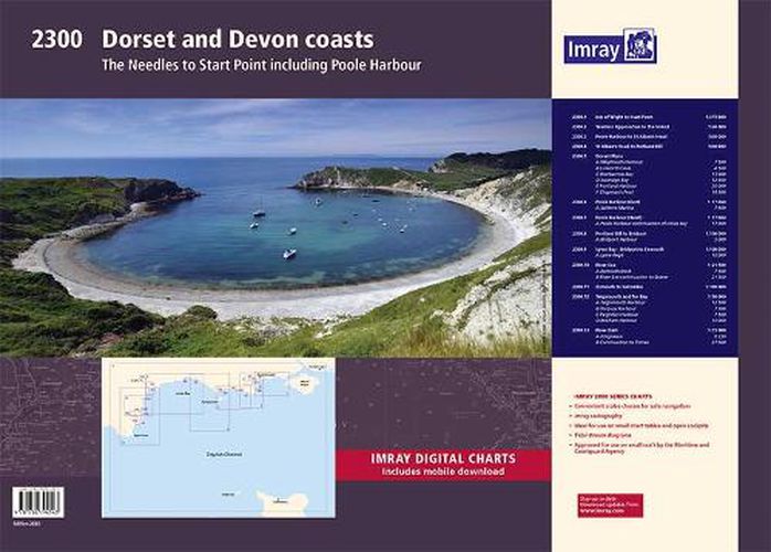
This fully revised and extended edition of our popular 2300 Dorset and Devon Coasts chart pack has been redesigned and expanded to 13 sheets and includes improved coastal coverage throughout.
The latest official UKHO data has been used and combined with additional information sourced from Imray's network to make it ideal for small craft. The chart pack includes all the navigational charts and tidal data for passage, approach, and mooring, and is designed to be used alongside The Shell Channel Pilot by Tom Cunliffe.
2300.1 Isle of Wight to Start Point (1:375 000)
2300.2 Western Approaches to the Solent (1:60 000)
2300.3 Poole Harbour to St Alban's Head (1:60 000)
2300.4 St Alban's Head to Portland Bill (1:60 000)
2300.5 Dorset Plans Plans: Weymouth Harbour (1:7500), Lulworth Cove (1:4500), Worbarrow Bay (1:15 000), Swanage Bay (1:12 500), Portland Harbour (1:20 000), Chapman's Pool (1:14 500)
2300.6 Poole Harbour (East) (1:17 000) Plan: Salterns Marina (1:7500)
2300.7 Poole Harbour (West) (1:17 000) Plan: Poole Harbour continuation of Holes Bay (1:17 000)
2300.8 Portland Bill to Bridport (1:100 000) Plan: Bridport Harbour (1:5000)
2300.9 Lyme Bay - Bridport to Exmouth (1:100 000) Plan: Lyme Regis (1:10 000)
2300.10 River Exe (1:21 500) Plans: Exmouth Dock (1:7500), River Exe continuation to Exeter (1:21 500)
2300.11 Exmouth to Salcombe (1:100 000)
2300.12 Teignmouth & Tor Bay (1:50 000) Plan: Teignmouth Harbour (1:12 500), Torquay Harbour (1:7700), Paignton Harbour (1:7500), Brixham Harbour (1:10 000)
2300.13 River Dart (1:15 000) Plans: Kingswear (1:6250), River Dart continuation to Totnes (1:27 500)
$9.00 standard shipping within Australia
FREE standard shipping within Australia for orders over $100.00
Express & International shipping calculated at checkout
This fully revised and extended edition of our popular 2300 Dorset and Devon Coasts chart pack has been redesigned and expanded to 13 sheets and includes improved coastal coverage throughout.
The latest official UKHO data has been used and combined with additional information sourced from Imray's network to make it ideal for small craft. The chart pack includes all the navigational charts and tidal data for passage, approach, and mooring, and is designed to be used alongside The Shell Channel Pilot by Tom Cunliffe.
2300.1 Isle of Wight to Start Point (1:375 000)
2300.2 Western Approaches to the Solent (1:60 000)
2300.3 Poole Harbour to St Alban's Head (1:60 000)
2300.4 St Alban's Head to Portland Bill (1:60 000)
2300.5 Dorset Plans Plans: Weymouth Harbour (1:7500), Lulworth Cove (1:4500), Worbarrow Bay (1:15 000), Swanage Bay (1:12 500), Portland Harbour (1:20 000), Chapman's Pool (1:14 500)
2300.6 Poole Harbour (East) (1:17 000) Plan: Salterns Marina (1:7500)
2300.7 Poole Harbour (West) (1:17 000) Plan: Poole Harbour continuation of Holes Bay (1:17 000)
2300.8 Portland Bill to Bridport (1:100 000) Plan: Bridport Harbour (1:5000)
2300.9 Lyme Bay - Bridport to Exmouth (1:100 000) Plan: Lyme Regis (1:10 000)
2300.10 River Exe (1:21 500) Plans: Exmouth Dock (1:7500), River Exe continuation to Exeter (1:21 500)
2300.11 Exmouth to Salcombe (1:100 000)
2300.12 Teignmouth & Tor Bay (1:50 000) Plan: Teignmouth Harbour (1:12 500), Torquay Harbour (1:7700), Paignton Harbour (1:7500), Brixham Harbour (1:10 000)
2300.13 River Dart (1:15 000) Plans: Kingswear (1:6250), River Dart continuation to Totnes (1:27 500)
Search our extensive online catalogue.
