Readings Newsletter
Become a Readings Member to make your shopping experience even easier.
Sign in or sign up for free!
You’re not far away from qualifying for FREE standard shipping within Australia
You’ve qualified for FREE standard shipping within Australia
The cart is loading…


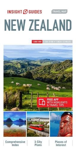
Travel Map New Zealand is an indexed map at 1: 800 000. It also includes maps of Auckland, Christchurch and Wellington. The North Island is shown on one side of the map; the South Island on the other. Places of interest are listed and accompanied by a wide range of pictorial symbols for instant recognition. These symbols have been colour-coded by category.
In addition to the road and rail networks, airports, major ports and shipping routes, this map provides a detailed picture of the topography through the use of relief shading.
This map has handy distance indicators in the margin and shows intermediate driving distances on main roads. The extensive legend is shown in 8 languages. Free destination app available to download.
$9.00 standard shipping within Australia
FREE standard shipping within Australia for orders over $100.00
Express & International shipping calculated at checkout
Stock availability can be subject to change without notice. We recommend calling the shop or contacting our online team to check availability of low stock items. Please see our Shopping Online page for more details.
Travel Map New Zealand is an indexed map at 1: 800 000. It also includes maps of Auckland, Christchurch and Wellington. The North Island is shown on one side of the map; the South Island on the other. Places of interest are listed and accompanied by a wide range of pictorial symbols for instant recognition. These symbols have been colour-coded by category.
In addition to the road and rail networks, airports, major ports and shipping routes, this map provides a detailed picture of the topography through the use of relief shading.
This map has handy distance indicators in the margin and shows intermediate driving distances on main roads. The extensive legend is shown in 8 languages. Free destination app available to download.
Search our extensive online catalogue.
