Readings Newsletter
Become a Readings Member to make your shopping experience even easier.
Sign in or sign up for free!
You’re not far away from qualifying for FREE standard shipping within Australia
You’ve qualified for FREE standard shipping within Australia
The cart is loading…


This title is printed to order. This book may have been self-published. If so, we cannot guarantee the quality of the content. In the main most books will have gone through the editing process however some may not. We therefore suggest that you be aware of this before ordering this book. If in doubt check either the author or publisher’s details as we are unable to accept any returns unless they are faulty. Please contact us if you have any questions.
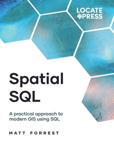
Spatial SQL: A Practical Approach to Modern GIS Using SQL
by Matthew Forrest
Learn to create, index and query spatial databases using SQL that applies to PostgreSQL/PostGIS and more.
Learn how to use Spatial SQL to analyze and manipulate geographic data. This book covers everything from basic spatial queries to advanced spatial analysis techniques all using SQL. Even if you don't know how SQL, this book starts from the beginning all the way to advanced queries.
Over 500 pages covers a comprehensive set of GIS topics.
Why SQL? - The evolution to modern GIS, why spatial SQL matters, and the spatial SQL landscape today
Setting up - Installing PostGIS with Docker on any operating system
Thinking in SQL - How to move from desktop GIS to SQL and learn how to structure queries independently
The basics of SQL - Import data to PostgreSQL and PostGIS, SQL data types, and core SQL operations
Advanced SQL - Statistical functions, joins, window functions, managing data, and user-defined functions
Using the GEOMETRY - Working with GEOMETRY and GEOGRAPHY data, data manipulation, and measurements
Spatial relationships - Spatial joins, distance relationships, clustering, and overlay functions
Spatial analysis - Recreate common spatial analysis "toolbox" tools all in spatial SQL
Advanced analysis - Data enrichment, line of sight, kernel density estimation, and more
Raster data - Importing, analyzing, interpolating, and using H3 spatial indexes with raster data in PostGIS
Suitability analysis - Importing, analyzing, interpolating, and using H3 spatial indexes with raster data in PostGIS
Routing with pgRouting - Routing for cars and bikes, travel time isochrones, and traveling salesperson problem
Spatial data science - Spatial autocorrelation, location allocation, and create territories with PySAL in PostGIS
$9.00 standard shipping within Australia
FREE standard shipping within Australia for orders over $100.00
Express & International shipping calculated at checkout
Stock availability can be subject to change without notice. We recommend calling the shop or contacting our online team to check availability of low stock items. Please see our Shopping Online page for more details.
This title is printed to order. This book may have been self-published. If so, we cannot guarantee the quality of the content. In the main most books will have gone through the editing process however some may not. We therefore suggest that you be aware of this before ordering this book. If in doubt check either the author or publisher’s details as we are unable to accept any returns unless they are faulty. Please contact us if you have any questions.
Spatial SQL: A Practical Approach to Modern GIS Using SQL
by Matthew Forrest
Learn to create, index and query spatial databases using SQL that applies to PostgreSQL/PostGIS and more.
Learn how to use Spatial SQL to analyze and manipulate geographic data. This book covers everything from basic spatial queries to advanced spatial analysis techniques all using SQL. Even if you don't know how SQL, this book starts from the beginning all the way to advanced queries.
Over 500 pages covers a comprehensive set of GIS topics.
Why SQL? - The evolution to modern GIS, why spatial SQL matters, and the spatial SQL landscape today
Setting up - Installing PostGIS with Docker on any operating system
Thinking in SQL - How to move from desktop GIS to SQL and learn how to structure queries independently
The basics of SQL - Import data to PostgreSQL and PostGIS, SQL data types, and core SQL operations
Advanced SQL - Statistical functions, joins, window functions, managing data, and user-defined functions
Using the GEOMETRY - Working with GEOMETRY and GEOGRAPHY data, data manipulation, and measurements
Spatial relationships - Spatial joins, distance relationships, clustering, and overlay functions
Spatial analysis - Recreate common spatial analysis "toolbox" tools all in spatial SQL
Advanced analysis - Data enrichment, line of sight, kernel density estimation, and more
Raster data - Importing, analyzing, interpolating, and using H3 spatial indexes with raster data in PostGIS
Suitability analysis - Importing, analyzing, interpolating, and using H3 spatial indexes with raster data in PostGIS
Routing with pgRouting - Routing for cars and bikes, travel time isochrones, and traveling salesperson problem
Spatial data science - Spatial autocorrelation, location allocation, and create territories with PySAL in PostGIS