Readings Newsletter
Become a Readings Member to make your shopping experience even easier.
Sign in or sign up for free!
You’re not far away from qualifying for FREE standard shipping within Australia
You’ve qualified for FREE standard shipping within Australia
The cart is loading…


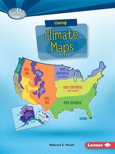
Ever wonder which states are the cloudiest? Or what city gets the most snow? Climate maps can tell you. They show average weather conditions. But how are climate maps made? Read on to learn the details!
$9.00 standard shipping within Australia
FREE standard shipping within Australia for orders over $100.00
Express & International shipping calculated at checkout
Stock availability can be subject to change without notice. We recommend calling the shop or contacting our online team to check availability of low stock items. Please see our Shopping Online page for more details.
Ever wonder which states are the cloudiest? Or what city gets the most snow? Climate maps can tell you. They show average weather conditions. But how are climate maps made? Read on to learn the details!
Search our extensive online catalogue.
