Readings Newsletter
Become a Readings Member to make your shopping experience even easier.
Sign in or sign up for free!
You’re not far away from qualifying for FREE standard shipping within Australia
You’ve qualified for FREE standard shipping within Australia
The cart is loading…


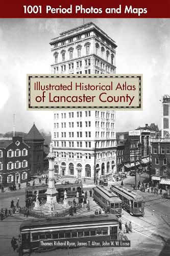
Lovers of Lancaster and maven map collectors will be delighted to own this beautiful atlas that offers a vivid and rare picture of life in historic Lancaster County, Pennsylvania.
More than just a large format, full-color reproduction of the original 1899 maps, Illustrated Historical Atlas of Lancaster County takes you on a complete tour of the county - township-by-township, borough-by-borough - from Elizabethtown to Little Britain, from Columbia to Terre Hill.
Spanning over three centuries, this book contains hundreds of maps and archival photos from local historical societies and private collections to provide a glimpse into the people, homes, places of worship, amusements, businesses, and more of the area throughout the 1900s. Go back in time and see the land you love from a whole new perspective!
$9.00 standard shipping within Australia
FREE standard shipping within Australia for orders over $100.00
Express & International shipping calculated at checkout
Lovers of Lancaster and maven map collectors will be delighted to own this beautiful atlas that offers a vivid and rare picture of life in historic Lancaster County, Pennsylvania.
More than just a large format, full-color reproduction of the original 1899 maps, Illustrated Historical Atlas of Lancaster County takes you on a complete tour of the county - township-by-township, borough-by-borough - from Elizabethtown to Little Britain, from Columbia to Terre Hill.
Spanning over three centuries, this book contains hundreds of maps and archival photos from local historical societies and private collections to provide a glimpse into the people, homes, places of worship, amusements, businesses, and more of the area throughout the 1900s. Go back in time and see the land you love from a whole new perspective!
Search our extensive online catalogue.
