Readings Newsletter
Become a Readings Member to make your shopping experience even easier.
Sign in or sign up for free!
You’re not far away from qualifying for FREE standard shipping within Australia
You’ve qualified for FREE standard shipping within Australia
The cart is loading…


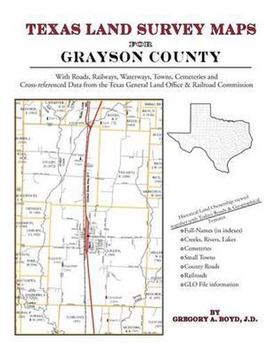
242 pages with 62 maps An indispensable book for any researcher interested in Grayson County’s history or land (or both), or its first landowners after Texas’s Independence from Mexico. Each book in this series is laid out into multiple maps using a 6 mile high by 4 mile wide grid.This book contains 57 Survey maps laid out within this grid. Each Land Survey Map shows the boundaries of original parcels laid out over existing roads, railroads, waterways. These are shown as well as the original Survey-Name and the Abstract Number assigned by the Texas General Land Office to the instrument that gave ownership to that parcel. Here are a number of details about our Grayson County book … Supplemental Maps Included (in addition to the primary Survey Maps) … - Where Grayson County Lies Within the State (Map A) - Grayson County and its Surrounding Counties (Map B) - An Index Map showing where each of the Land Survey Maps are within Grayson County (Map C) - An Index Map that builds upon Map C and shows the community-center points in relationship to the county-grid (Map D) - An Index Map that builds upon Map C and shows cemeteries listed in the USGS database in relationship to the county-grid (Map E) Primary Indexes (apart from each Survey-Map’s own index of survey-names) - An All-Name Index (alphabetical by last-name) for every person mentioned in the maps, utilizing both Texas General Land Office and Texas Railroad Commission data. - The Abstract Listing: this is where you find the real details behind each parcel of land.Items are listed by Abstract Number What Cities and Towns are in Grayson County, Texas (and in this book)? Ambrose, Basin Springs, Bells, Bona, Cambridge, Canaan, Cannon, Carpenters Bluff, Cedar Mills, Collinsville, Denison, Dixie, Dorchester, Ellsworth, Elm View, Elmont, Ethel, Farmington, Fink, Frontier Village, Gage, Glen Eden (historical), Gordonville, Gover, Gunter, Hanger, Hilton, Hishway, Howe, Ida, Joe, Kentucky Town, Knollwood, Locust, Luella, Macomb, Mayd, Mills, Mormon Grove (historical), North Sherman Junction, Penland, Pilot Grove, Pottsboro, Preston, Ray, Red Branch, Red River City, Sadler, Sandusky, Shawnee, Sherman, Sherman Junction, Sherwood Shores, Sherwood Shores, Smith Oaks, Southmayd, Sperry, Steedham, Terrace, Theodore, Thorne, Tioga, Tom Bean, Tribune, Twin City, Van Alstyne, Warner Junction, White Mound, Whiterock, Whitesboro, Whitewright, Willow Spring, Woodlake Park
$9.00 standard shipping within Australia
FREE standard shipping within Australia for orders over $100.00
Express & International shipping calculated at checkout
242 pages with 62 maps An indispensable book for any researcher interested in Grayson County’s history or land (or both), or its first landowners after Texas’s Independence from Mexico. Each book in this series is laid out into multiple maps using a 6 mile high by 4 mile wide grid.This book contains 57 Survey maps laid out within this grid. Each Land Survey Map shows the boundaries of original parcels laid out over existing roads, railroads, waterways. These are shown as well as the original Survey-Name and the Abstract Number assigned by the Texas General Land Office to the instrument that gave ownership to that parcel. Here are a number of details about our Grayson County book … Supplemental Maps Included (in addition to the primary Survey Maps) … - Where Grayson County Lies Within the State (Map A) - Grayson County and its Surrounding Counties (Map B) - An Index Map showing where each of the Land Survey Maps are within Grayson County (Map C) - An Index Map that builds upon Map C and shows the community-center points in relationship to the county-grid (Map D) - An Index Map that builds upon Map C and shows cemeteries listed in the USGS database in relationship to the county-grid (Map E) Primary Indexes (apart from each Survey-Map’s own index of survey-names) - An All-Name Index (alphabetical by last-name) for every person mentioned in the maps, utilizing both Texas General Land Office and Texas Railroad Commission data. - The Abstract Listing: this is where you find the real details behind each parcel of land.Items are listed by Abstract Number What Cities and Towns are in Grayson County, Texas (and in this book)? Ambrose, Basin Springs, Bells, Bona, Cambridge, Canaan, Cannon, Carpenters Bluff, Cedar Mills, Collinsville, Denison, Dixie, Dorchester, Ellsworth, Elm View, Elmont, Ethel, Farmington, Fink, Frontier Village, Gage, Glen Eden (historical), Gordonville, Gover, Gunter, Hanger, Hilton, Hishway, Howe, Ida, Joe, Kentucky Town, Knollwood, Locust, Luella, Macomb, Mayd, Mills, Mormon Grove (historical), North Sherman Junction, Penland, Pilot Grove, Pottsboro, Preston, Ray, Red Branch, Red River City, Sadler, Sandusky, Shawnee, Sherman, Sherman Junction, Sherwood Shores, Sherwood Shores, Smith Oaks, Southmayd, Sperry, Steedham, Terrace, Theodore, Thorne, Tioga, Tom Bean, Tribune, Twin City, Van Alstyne, Warner Junction, White Mound, Whiterock, Whitesboro, Whitewright, Willow Spring, Woodlake Park
Search our extensive online catalogue.
