Readings Newsletter
Become a Readings Member to make your shopping experience even easier.
Sign in or sign up for free!
You’re not far away from qualifying for FREE standard shipping within Australia
You’ve qualified for FREE standard shipping within Australia
The cart is loading…


This title is printed to order. This book may have been self-published. If so, we cannot guarantee the quality of the content. In the main most books will have gone through the editing process however some may not. We therefore suggest that you be aware of this before ordering this book. If in doubt check either the author or publisher’s details as we are unable to accept any returns unless they are faulty. Please contact us if you have any questions.
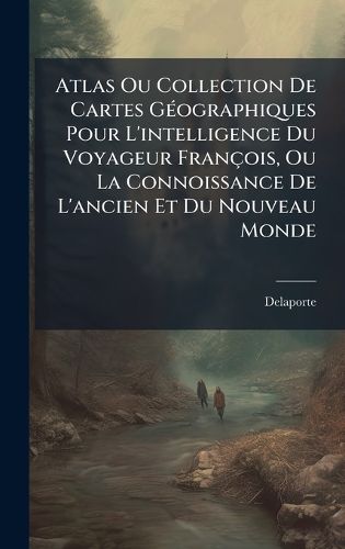
Explore the world as seen through the eyes of 18th-century French travelers with the "Atlas Ou Collection De Cartes Geographiques Pour L'intelligence Du Voyageur Francois, Ou La Connoissance De L'ancien Et Du Nouveau Monde." This meticulously crafted atlas, compiled by Abbe Delaporte, offers a fascinating glimpse into the geographical understanding of the era. Featuring detailed maps of both the Old and New Worlds, this collection provides invaluable insights for those seeking to understand the historical context of travel and exploration during this period.
Delaporte's work is more than just a compilation of maps; it is a window into the intellectual and cultural milieu of 18th-century France. Whether you are a historian, a cartography enthusiast, or simply a curious reader, this atlas offers a rich and rewarding journey through time and space. Discover the world as it was known, understood, and imagined by the travelers of a bygone era.
This work has been selected by scholars as being culturally important, and is part of the knowledge base of civilization as we know it. This work was reproduced from the original artifact, and remains as true to the original work as possible. Therefore, you will see the original copyright references, library stamps (as most of these works have been housed in our most important libraries around the world), and other notations in the work.
This work is in the public domain in the United States of America, and possibly other nations. Within the United States, you may freely copy and distribute this work, as no entity (individual or corporate) has a copyright on the body of the work.
As a reproduction of a historical artifact, this work may contain missing or blurred pages, poor pictures, errant marks, etc. Scholars believe, and we concur, that this work is important enough to be preserved, reproduced, and made generally available to the public. We appreciate your support of the preservation process, and thank you for being an important part of keeping this knowledge alive and relevant.
$9.00 standard shipping within Australia
FREE standard shipping within Australia for orders over $100.00
Express & International shipping calculated at checkout
This title is printed to order. This book may have been self-published. If so, we cannot guarantee the quality of the content. In the main most books will have gone through the editing process however some may not. We therefore suggest that you be aware of this before ordering this book. If in doubt check either the author or publisher’s details as we are unable to accept any returns unless they are faulty. Please contact us if you have any questions.
Explore the world as seen through the eyes of 18th-century French travelers with the "Atlas Ou Collection De Cartes Geographiques Pour L'intelligence Du Voyageur Francois, Ou La Connoissance De L'ancien Et Du Nouveau Monde." This meticulously crafted atlas, compiled by Abbe Delaporte, offers a fascinating glimpse into the geographical understanding of the era. Featuring detailed maps of both the Old and New Worlds, this collection provides invaluable insights for those seeking to understand the historical context of travel and exploration during this period.
Delaporte's work is more than just a compilation of maps; it is a window into the intellectual and cultural milieu of 18th-century France. Whether you are a historian, a cartography enthusiast, or simply a curious reader, this atlas offers a rich and rewarding journey through time and space. Discover the world as it was known, understood, and imagined by the travelers of a bygone era.
This work has been selected by scholars as being culturally important, and is part of the knowledge base of civilization as we know it. This work was reproduced from the original artifact, and remains as true to the original work as possible. Therefore, you will see the original copyright references, library stamps (as most of these works have been housed in our most important libraries around the world), and other notations in the work.
This work is in the public domain in the United States of America, and possibly other nations. Within the United States, you may freely copy and distribute this work, as no entity (individual or corporate) has a copyright on the body of the work.
As a reproduction of a historical artifact, this work may contain missing or blurred pages, poor pictures, errant marks, etc. Scholars believe, and we concur, that this work is important enough to be preserved, reproduced, and made generally available to the public. We appreciate your support of the preservation process, and thank you for being an important part of keeping this knowledge alive and relevant.
Search our extensive online catalogue.
