Readings Newsletter
Become a Readings Member to make your shopping experience even easier.
Sign in or sign up for free!
You’re not far away from qualifying for FREE standard shipping within Australia
You’ve qualified for FREE standard shipping within Australia
The cart is loading…


This title is printed to order. This book may have been self-published. If so, we cannot guarantee the quality of the content. In the main most books will have gone through the editing process however some may not. We therefore suggest that you be aware of this before ordering this book. If in doubt check either the author or publisher’s details as we are unable to accept any returns unless they are faulty. Please contact us if you have any questions.
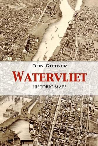
This collection of historic maps over the centuries depicts the evolution of Watervliet, New York, from a river plain to an important and early manufacturing center in the Capital District. This fourth volume presents many maps from the 17th to 20th centuries that show the early settlers of the region and the communities they created such as the villages of Washington, Gibbonsville, Port Schuyler, West Troy and finally the city of Watervliet. There is an old saying, A Picture is Worth a Thousands Words, but a map is worth a thousands stories. This is the last of the four volume set on the History of Watervliet, NY.
$9.00 standard shipping within Australia
FREE standard shipping within Australia for orders over $100.00
Express & International shipping calculated at checkout
Stock availability can be subject to change without notice. We recommend calling the shop or contacting our online team to check availability of low stock items. Please see our Shopping Online page for more details.
This title is printed to order. This book may have been self-published. If so, we cannot guarantee the quality of the content. In the main most books will have gone through the editing process however some may not. We therefore suggest that you be aware of this before ordering this book. If in doubt check either the author or publisher’s details as we are unable to accept any returns unless they are faulty. Please contact us if you have any questions.
This collection of historic maps over the centuries depicts the evolution of Watervliet, New York, from a river plain to an important and early manufacturing center in the Capital District. This fourth volume presents many maps from the 17th to 20th centuries that show the early settlers of the region and the communities they created such as the villages of Washington, Gibbonsville, Port Schuyler, West Troy and finally the city of Watervliet. There is an old saying, A Picture is Worth a Thousands Words, but a map is worth a thousands stories. This is the last of the four volume set on the History of Watervliet, NY.
Search our extensive online catalogue.
