Readings Newsletter
Become a Readings Member to make your shopping experience even easier.
Sign in or sign up for free!
You’re not far away from qualifying for FREE standard shipping within Australia
You’ve qualified for FREE standard shipping within Australia
The cart is loading…


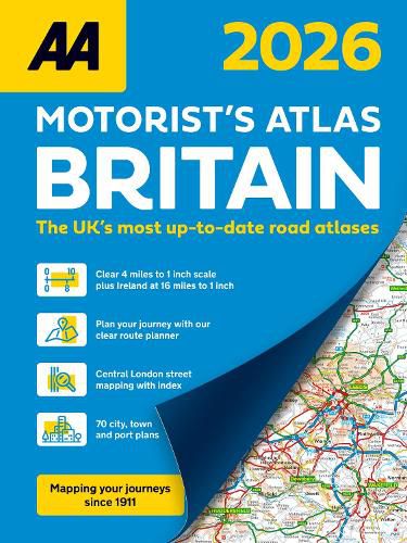
This A4 format spiral bound road atlas provides super-clear mapping at 4 miles to 1 inch. Fully updated mapping with 70 city, town and port plans, top 300 AA-Inspected caravan and camping sites, district mapping of Birmingham, Glasgow, Manchester, London and Newcastle.
Each page has been titled with its geographical location so you can turn to the page you need more easily. Wide minor roads (more than and less than 4m wide), National Trust, English and World Heritage sites, crematorium locations and other hard-to-find places are also shown.
Including 70 city, town and port plans and 10 pages of central London mapping with index. A comprehensive 31,500 entry index with airports, top tourist sites and motorway services listed. The ferry port plans are inset on the mapping for ease of reference. Scenic routes, tourist sites and caravan and camping sites are symbolised on the mapping.
$9.00 standard shipping within Australia
FREE standard shipping within Australia for orders over $100.00
Express & International shipping calculated at checkout
This A4 format spiral bound road atlas provides super-clear mapping at 4 miles to 1 inch. Fully updated mapping with 70 city, town and port plans, top 300 AA-Inspected caravan and camping sites, district mapping of Birmingham, Glasgow, Manchester, London and Newcastle.
Each page has been titled with its geographical location so you can turn to the page you need more easily. Wide minor roads (more than and less than 4m wide), National Trust, English and World Heritage sites, crematorium locations and other hard-to-find places are also shown.
Including 70 city, town and port plans and 10 pages of central London mapping with index. A comprehensive 31,500 entry index with airports, top tourist sites and motorway services listed. The ferry port plans are inset on the mapping for ease of reference. Scenic routes, tourist sites and caravan and camping sites are symbolised on the mapping.
Search our extensive online catalogue.
