Readings Newsletter
Become a Readings Member to make your shopping experience even easier.
Sign in or sign up for free!
You’re not far away from qualifying for FREE standard shipping within Australia
You’ve qualified for FREE standard shipping within Australia
The cart is loading…


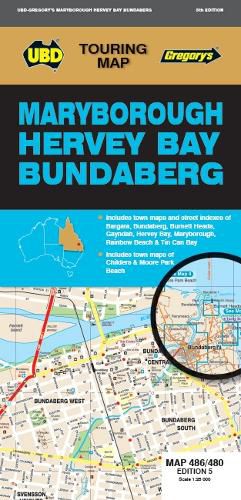
The latest edition of theMaryborough Hervey Bay Bundaberg Map is a handy tool for both the tourist and locals wanting to find their way around the area. It has been fully revised and updated and includes:
A regional touring map covering along the coast from Broadwater Conservation Park in the north and Peregian Springs in the south, Inland from Bulburin National Park in the north and Kingaroy in the south, and west to Gayndah, with Fraser Island also included; Maps and street indexes for Bundaberg, Hervey Bay and Maryborough; Maps of Bargara, Childers, Gayndah, Moore Park Beach, Rainbow Beach and Tin Can Bay; and a list of regional touring attractions and advertisers.
$9.00 standard shipping within Australia
FREE standard shipping within Australia for orders over $100.00
Express & International shipping calculated at checkout
The latest edition of theMaryborough Hervey Bay Bundaberg Map is a handy tool for both the tourist and locals wanting to find their way around the area. It has been fully revised and updated and includes:
A regional touring map covering along the coast from Broadwater Conservation Park in the north and Peregian Springs in the south, Inland from Bulburin National Park in the north and Kingaroy in the south, and west to Gayndah, with Fraser Island also included; Maps and street indexes for Bundaberg, Hervey Bay and Maryborough; Maps of Bargara, Childers, Gayndah, Moore Park Beach, Rainbow Beach and Tin Can Bay; and a list of regional touring attractions and advertisers.
Search our extensive online catalogue.
