Readings Newsletter
Become a Readings Member to make your shopping experience even easier.
Sign in or sign up for free!
You’re not far away from qualifying for FREE standard shipping within Australia
You’ve qualified for FREE standard shipping within Australia
The cart is loading…


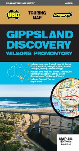
This newest edition of the Gippsland Discovery and Wilsons Promontory touring map is an essential tool to use when travelling in the area.
With a regional map and towns index covering Buxton in the north, Wilsons Promontory in the south, Heyfield in the east and Craigieburn in the south.
There is also street level mapping and town descriptions for the towns of Churchill, Cowes, Inverloch, Korumburra, Leongatha, Moe, Morwell, Traralgon, Warragul and Yarram and town maps of Drouin and Trafalgar.
Phillip Island is also covered with street maps of Cowes, Newhaven, San Remo, Smiths Beach and Summerlands.
There are detailed descriptions of the top attractions and activities throughout the region and a list of Visitor Information Centres.
$9.00 standard shipping within Australia
FREE standard shipping within Australia for orders over $100.00
Express & International shipping calculated at checkout
This newest edition of the Gippsland Discovery and Wilsons Promontory touring map is an essential tool to use when travelling in the area.
With a regional map and towns index covering Buxton in the north, Wilsons Promontory in the south, Heyfield in the east and Craigieburn in the south.
There is also street level mapping and town descriptions for the towns of Churchill, Cowes, Inverloch, Korumburra, Leongatha, Moe, Morwell, Traralgon, Warragul and Yarram and town maps of Drouin and Trafalgar.
Phillip Island is also covered with street maps of Cowes, Newhaven, San Remo, Smiths Beach and Summerlands.
There are detailed descriptions of the top attractions and activities throughout the region and a list of Visitor Information Centres.
Search our extensive online catalogue.
