Readings Newsletter
Become a Readings Member to make your shopping experience even easier.
Sign in or sign up for free!
You’re not far away from qualifying for FREE standard shipping within Australia
You’ve qualified for FREE standard shipping within Australia
The cart is loading…


This title is printed to order. This book may have been self-published. If so, we cannot guarantee the quality of the content. In the main most books will have gone through the editing process however some may not. We therefore suggest that you be aware of this before ordering this book. If in doubt check either the author or publisher’s details as we are unable to accept any returns unless they are faulty. Please contact us if you have any questions.
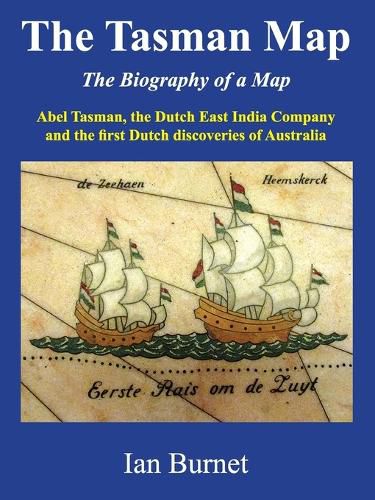
The Tasman Map is an icon of early Dutch cartography and shows the first European discoveries of Australia. Based on sixteen separate discoveries, the first map of Australia took shape over a period of only forty years, from 1606 to 1644. It shows a recognisable outline of the north, west, and south coasts of Australia that was not to change for another 125 years until the arrival of the British explorer James Cook. The version of the map held by the Mitchell Library in Sydney, Australia, is hand-drawn on delicate Japanese paper and is thought to have been specially prepared for presentation to the Amsterdam Chamber of the Dutch East India Company. Every visitor who passes through the vestibule of the Mitchell Library stops to admire the magnificent marble mosaic of the Tasman Map, which fills the entire vestibule floor and shows Abel Tasman's voyages of exploration around Australia in 1642/43 and 1644.
$9.00 standard shipping within Australia
FREE standard shipping within Australia for orders over $100.00
Express & International shipping calculated at checkout
Stock availability can be subject to change without notice. We recommend calling the shop or contacting our online team to check availability of low stock items. Please see our Shopping Online page for more details.
This title is printed to order. This book may have been self-published. If so, we cannot guarantee the quality of the content. In the main most books will have gone through the editing process however some may not. We therefore suggest that you be aware of this before ordering this book. If in doubt check either the author or publisher’s details as we are unable to accept any returns unless they are faulty. Please contact us if you have any questions.
The Tasman Map is an icon of early Dutch cartography and shows the first European discoveries of Australia. Based on sixteen separate discoveries, the first map of Australia took shape over a period of only forty years, from 1606 to 1644. It shows a recognisable outline of the north, west, and south coasts of Australia that was not to change for another 125 years until the arrival of the British explorer James Cook. The version of the map held by the Mitchell Library in Sydney, Australia, is hand-drawn on delicate Japanese paper and is thought to have been specially prepared for presentation to the Amsterdam Chamber of the Dutch East India Company. Every visitor who passes through the vestibule of the Mitchell Library stops to admire the magnificent marble mosaic of the Tasman Map, which fills the entire vestibule floor and shows Abel Tasman's voyages of exploration around Australia in 1642/43 and 1644.
Search our extensive online catalogue.
