Readings Newsletter
Become a Readings Member to make your shopping experience even easier.
Sign in or sign up for free!
You’re not far away from qualifying for FREE standard shipping within Australia
You’ve qualified for FREE standard shipping within Australia
The cart is loading…


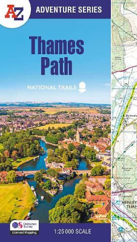
The A-Z Adventure series features the accuracy and quality of Ordnance Survey's 1:25000 mapping in a convenient book, therefore eliminating the need to fold and re-fold a large sheet map to the desired area.
OS 1:25 000 is Ordnance Survey's most detailed mapping, showing public rights of way, open access land, national parks, tourist information, car parks, public houses and camping and caravan sites.
The Thames Path is a National Trail which covers 298km (185 miles) and follows the length of Englands longest river, the Thames, from its source in the Cotswolds to the Thames Barrier in Greenwich, London.
This A-Z Adventure Atlas of the Thames Path features 61 pages of continuous Ordnance Survey mapping providing complete coverage of the Thames Path. Clearly highlighted in yellow, the route is easy to identify and shows both north and south bank alternatives. In addition mileage markers have been introduced to the map making it easy to gauge distances when planning your own sections of the walk to enjoy.
A route planner is also included providing distances between places and the amenities available, featuring:
Information Centres Hotels/B&Bs Youth Hostels Campsites (seasonal opening) Pubs, shops, restaurants, and cafes (seasonal opening) Petrol Stations
Also featured is advice on safety and security when walking and details of Tourist Information Centres.
This A-Z Adventure Atlas has the accuracy and quality of OS 1:25000 mapping indexed within a book, making it the perfect companion for walkers, off-road cyclists, horse riders and anyone wishing to explore the great outdoors.
Other National Trails available within the A-Z Adventure series: Coast to Coast, Cotswold Way, Pembrokeshire Coast Path, South Downs Way, and SW Coast Path.
$9.00 standard shipping within Australia
FREE standard shipping within Australia for orders over $100.00
Express & International shipping calculated at checkout
Stock availability can be subject to change without notice. We recommend calling the shop or contacting our online team to check availability of low stock items. Please see our Shopping Online page for more details.
The A-Z Adventure series features the accuracy and quality of Ordnance Survey's 1:25000 mapping in a convenient book, therefore eliminating the need to fold and re-fold a large sheet map to the desired area.
OS 1:25 000 is Ordnance Survey's most detailed mapping, showing public rights of way, open access land, national parks, tourist information, car parks, public houses and camping and caravan sites.
The Thames Path is a National Trail which covers 298km (185 miles) and follows the length of Englands longest river, the Thames, from its source in the Cotswolds to the Thames Barrier in Greenwich, London.
This A-Z Adventure Atlas of the Thames Path features 61 pages of continuous Ordnance Survey mapping providing complete coverage of the Thames Path. Clearly highlighted in yellow, the route is easy to identify and shows both north and south bank alternatives. In addition mileage markers have been introduced to the map making it easy to gauge distances when planning your own sections of the walk to enjoy.
A route planner is also included providing distances between places and the amenities available, featuring:
Information Centres Hotels/B&Bs Youth Hostels Campsites (seasonal opening) Pubs, shops, restaurants, and cafes (seasonal opening) Petrol Stations
Also featured is advice on safety and security when walking and details of Tourist Information Centres.
This A-Z Adventure Atlas has the accuracy and quality of OS 1:25000 mapping indexed within a book, making it the perfect companion for walkers, off-road cyclists, horse riders and anyone wishing to explore the great outdoors.
Other National Trails available within the A-Z Adventure series: Coast to Coast, Cotswold Way, Pembrokeshire Coast Path, South Downs Way, and SW Coast Path.
Search our extensive online catalogue.
