Readings Newsletter
Become a Readings Member to make your shopping experience even easier.
Sign in or sign up for free!
You’re not far away from qualifying for FREE standard shipping within Australia
You’ve qualified for FREE standard shipping within Australia
The cart is loading…


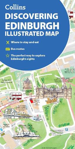
Explore new places with dependable maps from Collins.This brand new edition retains the delightful water-colour mapping, with individual paintings of all the main sights and landmarks.
This brand new edition retains the delightful water-colour mapping, with individual paintings of all the main sights and landmarks.
Popular areas at larger scale, hundreds of shops, restaurants, cafes and bars, comprehensive travel information and index.
This map includes:
Large-scale plans of the Castle, Royal Mile, Botanic Gardens, Leith and Newington
Shop-by-shop street maps of Princes Street, George Street, Victoria Street and the Grassmarket
Railway stations, bus routes, taxi ranks and car parks
Historical and contemporary anecdotes
Suggestions for day trips out of the city
Comprehensive index
Area of coverage:
Covers the centre of Edinburgh from Inverleith Park in the north to The Meadows in the south, and from the Scottish National Gallery of Modern Art in the west to the Palace of Holyroodhouse in the east.
The perfect companion to Edinburgh for visitors and locals alike.
$9.00 standard shipping within Australia
FREE standard shipping within Australia for orders over $100.00
Express & International shipping calculated at checkout
Explore new places with dependable maps from Collins.This brand new edition retains the delightful water-colour mapping, with individual paintings of all the main sights and landmarks.
This brand new edition retains the delightful water-colour mapping, with individual paintings of all the main sights and landmarks.
Popular areas at larger scale, hundreds of shops, restaurants, cafes and bars, comprehensive travel information and index.
This map includes:
Large-scale plans of the Castle, Royal Mile, Botanic Gardens, Leith and Newington
Shop-by-shop street maps of Princes Street, George Street, Victoria Street and the Grassmarket
Railway stations, bus routes, taxi ranks and car parks
Historical and contemporary anecdotes
Suggestions for day trips out of the city
Comprehensive index
Area of coverage:
Covers the centre of Edinburgh from Inverleith Park in the north to The Meadows in the south, and from the Scottish National Gallery of Modern Art in the west to the Palace of Holyroodhouse in the east.
The perfect companion to Edinburgh for visitors and locals alike.
Search our extensive online catalogue.
