Readings Newsletter
Become a Readings Member to make your shopping experience even easier.
Sign in or sign up for free!
You’re not far away from qualifying for FREE standard shipping within Australia
You’ve qualified for FREE standard shipping within Australia
The cart is loading…


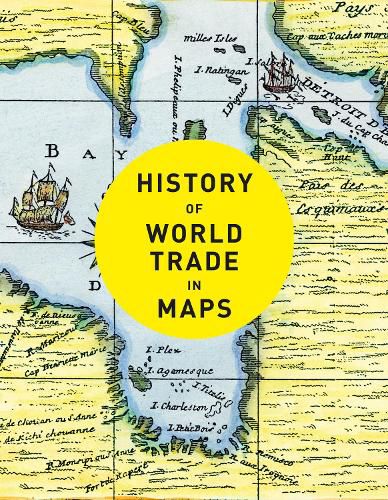
A beautful book for anyone interested in exploring the history of trade in maps.
Trade is the lifeblood of nations. It has provided vital goods and wealth to countries and merchants from the ancient Egyptians who went in search of gold and ivory to their 21st-century equivalents trading high-tech electronic equipment from the Far East.
In this beautiful book, more than 70 maps give a visual representation of the history of World Commerce, accompanied by text which tells the extraordinary story of the merchants, adventurers, middle-men and monarchs who bought, sold, explored and fought in search of profit and power.
The maps are all works of art, witnesses to history, and have a fascinating story to tell.
The maps include * Catalhoeyuk Plan, c. 6200BC * Babylonian Map of the World, c. 600BC * Stone Map of China, 1136 * Hereford Mappa Mundi, c. 1300 * Buondelmonti Map of Constantinople, c. 1420 * The Waldseemuller Map, 1507 * James Rennell Map of Hindoostan, 1782 * Air Age Map, 1945 * Johns Hopkins Covid-19 Dashboard, 2020
$9.00 standard shipping within Australia
FREE standard shipping within Australia for orders over $100.00
Express & International shipping calculated at checkout
A beautful book for anyone interested in exploring the history of trade in maps.
Trade is the lifeblood of nations. It has provided vital goods and wealth to countries and merchants from the ancient Egyptians who went in search of gold and ivory to their 21st-century equivalents trading high-tech electronic equipment from the Far East.
In this beautiful book, more than 70 maps give a visual representation of the history of World Commerce, accompanied by text which tells the extraordinary story of the merchants, adventurers, middle-men and monarchs who bought, sold, explored and fought in search of profit and power.
The maps are all works of art, witnesses to history, and have a fascinating story to tell.
The maps include * Catalhoeyuk Plan, c. 6200BC * Babylonian Map of the World, c. 600BC * Stone Map of China, 1136 * Hereford Mappa Mundi, c. 1300 * Buondelmonti Map of Constantinople, c. 1420 * The Waldseemuller Map, 1507 * James Rennell Map of Hindoostan, 1782 * Air Age Map, 1945 * Johns Hopkins Covid-19 Dashboard, 2020
Search our extensive online catalogue.
