


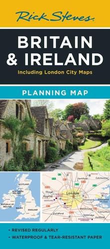
Rick Steves Britain & Ireland Planning Map
Rick Steves
Rick Steves Britain & Ireland Planning Map
Rick Steves
Designed for Rick Steves fans, this map highlights Great Britain and Ireland's best destinations in a colourful, easy-to-use format on high-quality paper:
Cuts the Clutter: While big cities are included for navigational purposes, this map focuses on Rick's favourite spots for travellers
Guidebook-Friendly: At a glance, all the places you read about in Rick Steves' guidebooks stand out in a crisp, easy-to-read format
Durable Construction: This map is printed on tearproof paper to last over many trips
Road or Sea: Includes highways, ferry routes, bus stops, and train lines for easy route-planning
The Back's Even Better: The reverse side includes a detailed city-centre map of London locating sights, hotels, and restaurants
Order online and we’ll ship when available (9 July 2024)
Our stock data is updated periodically, and availability may change throughout the day for in-demand items. Please call the relevant shop for the most current stock information. Prices are subject to change without notice.
Sign in or become a Readings Member to add this title to a wishlist.