Readings Newsletter
Become a Readings Member to make your shopping experience even easier.
Sign in or sign up for free!
You’re not far away from qualifying for FREE standard shipping within Australia
You’ve qualified for FREE standard shipping within Australia
The cart is loading…


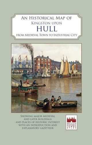
Map reverse carries an illustrated gazetteer of sites of interest: approx. 6,600 wordsMap cover carries inside a brief history of Hull: 1,300 words. Illustrations: coloured engravings and early views of buildings, monuments and street scenesA full colour map, based on an Ordnance Survey map of 1928, with buildings and sites of interest picked out. Few cities have experienced Hull’s uninterrupted position as one of Britain’s leading centres of population and economic activity over nine centuries. The variety and richness of its architecture are too often overlooked. The map shows the main medieval and post-medieval buildings in this remarkable and interesting city, the second-most historic city of Yorkshire. The map’s cover has a short introduction to the city’s history, and on the reverse an illustrated and comprehensive gazetteer of Hull’s main buildings and sites of interest, from medieval monasteries to cinemas and theatres, and the huge fortified citadel.
$9.00 standard shipping within Australia
FREE standard shipping within Australia for orders over $100.00
Express & International shipping calculated at checkout
Map reverse carries an illustrated gazetteer of sites of interest: approx. 6,600 wordsMap cover carries inside a brief history of Hull: 1,300 words. Illustrations: coloured engravings and early views of buildings, monuments and street scenesA full colour map, based on an Ordnance Survey map of 1928, with buildings and sites of interest picked out. Few cities have experienced Hull’s uninterrupted position as one of Britain’s leading centres of population and economic activity over nine centuries. The variety and richness of its architecture are too often overlooked. The map shows the main medieval and post-medieval buildings in this remarkable and interesting city, the second-most historic city of Yorkshire. The map’s cover has a short introduction to the city’s history, and on the reverse an illustrated and comprehensive gazetteer of Hull’s main buildings and sites of interest, from medieval monasteries to cinemas and theatres, and the huge fortified citadel.
Search our extensive online catalogue.
